
Walk a Lawrence Street Directory from One Address
A reliable by-address search moves through different records in a set order. The first task is to establish the modern parcel and exact situs. The next steps add legal transfers, map context, voter confirmation for a known person, and historical evidence. None of these sources alone identifies every household member.
- Preserve the address exactly as printed, including East or West, street type, apartment or unit, and the source date.
- Search Douglas County Property Information and copy the situs, mailing address, owner, Quick Ref ID, PIN, and legal description.
- Open the county Tax Parcel layer or Lawrence Atlas, locate the polygon, and compare the street segment, lot shape, subdivision, and nearby parcels.
- Use the sales book and page in Landmark, then record each grantor, grantee, document type, date, and legal description.
- If a particular person is already known, use VoterView for individual registration confirmation. It cannot browse the block.
- For an older occupant clue, search a reverse directory first, then the alphabetic directory, and save the edition, page, and printed form.
This sequence makes a Lawrence street directory useful for genealogy, house history, estate research, or a careful property inquiry without turning an owner list into an occupant list.
Search Lawrence Streets in Property Information
The Douglas County portal is the main current address-keyed source. Its quick search accepts any combination of name, address, or property identifier, begins autocomplete after three characters, and offers a wider result list when more than nine matches appear. The initial grid can show owner, address, account, and property ID, with more parcel columns available.
| Portal field | Street-directory use | Reading limit |
|---|---|---|
| Name, address, property identifier | Find the target parcel from the detail already known | A broad street query needs its filter and result count saved |
| OwnerName and SitusAddress | Connect an owner field to the physical property address | Ownership does not prove who occupies the site |
| Mailing address | Shows where tax correspondence is sent | It can belong to a trust or representative |
| Quick Ref ID, PIN, account, RE Tax ID | Carry the parcel into county map and tax workflows | Do not treat identifiers as interchangeable |
| Legal description, subdivision, neighborhood | Bridge a street number to a plat or deed | A neighborhood field does not prove group membership |
| Sales instrument, book, page | Open the matching land record in Landmark | The deed names recorded parties, not a whole household |
The Douglas County advanced property route is the source for the address-search screen.
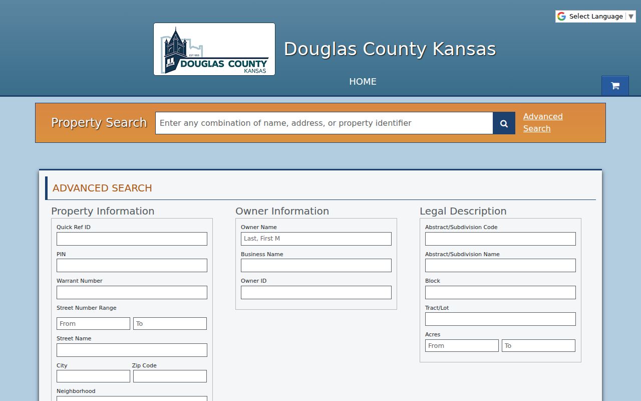
The portal’s current migration route reinforces the need to save the Quick Ref ID and the inspection date with each result.
Read the Lawrence Parcel Card Before Naming a Resident
A property detail page adds the fields that make a street search auditable. General Information can include property status and type, legal description, taxing group, neighborhood, PIN, related properties, map number, and legacy ID. Owner Info separates the owner, owner ID, exemptions, and mailing address. Value, sales, deed, tax, and payment sections serve their own administrative purposes.
Compare four items: the situs address, mailing address, legal description, and GIS polygon. If those agree on the same place, the record supports a parcel statement. It still does not prove that the owner or mailing recipient lives there. The exemption field also needs an Appraiser explanation before it is read as an owner-occupancy flag.
The sample Douglas County parcel detail demonstrates the card layout without supplying a household list.
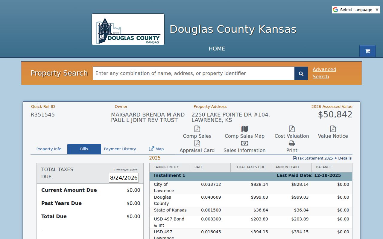
The card shows why a Lawrence street directory must label owner, situs, mailing recipient, and deed party as separate roles.
Lawrence GIS Turns a Street into Parcels and Layers
The county Tax Parcel service is polygon data maintained daily, as needed, or continuously through the conveyance workflow. Its fields include owner lines, address, city, state, ZIP, deed, book, page, tax unit, school, legal description, PID, Quick Ref ID, situs, and geometry. Query, identify, pagination, and map operations allow a researcher to follow the parcels on a street while retaining a record of the filter and map extent.
Lawrence Atlas adds address search, aerial photography, historic-property, floodplain, neighborhood, city-limit, zoning, utility, measurement, drawing, and print layers. Layer dates differ, so cite the layer and date rather than treating a screenshot as timeless. A parcel polygon is a maintained administrative product, not a legal survey.
The Lawrence GIS and maps page supplies the city map and Atlas access.
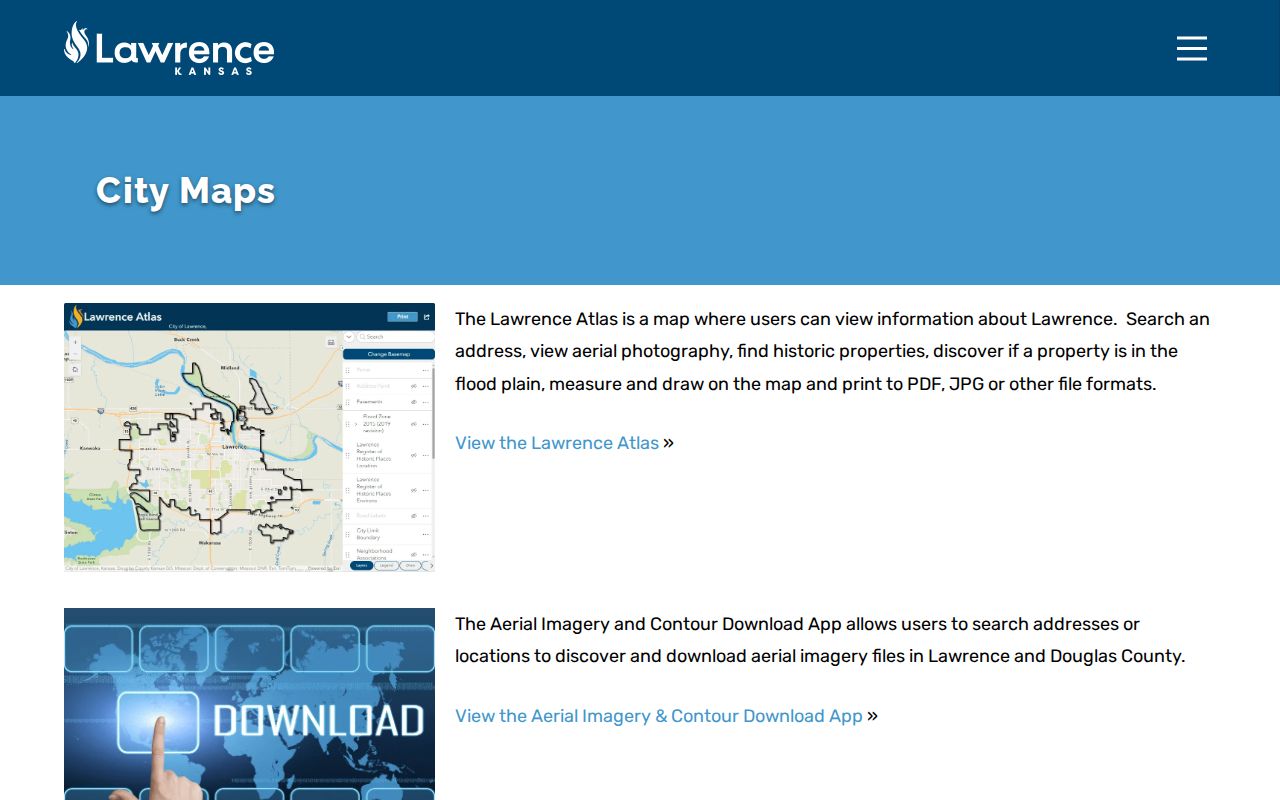
The map tools add place context to parcel evidence but do not establish who belongs to a household or neighborhood group.
Lawrence Address Records Available by Street
Each address-keyed source answers a different question. A complete Lawrence street directory comparison should record the custodian, fields, access channel, date, and limits before names are placed side by side.
| Lawrence record | Keeper | What the address can reveal | Access and fallback |
|---|---|---|---|
| Property and tax parcel | Douglas County Appraiser | Owner, situs, mailing, parcel IDs, legal, value and sales links | Property Information; 785-832-5133 or office |
| Tax Parcel GIS | Douglas County GIS workflow | Polygon, nearby parcels, owner and situs fields, legal, book/page | Viewer or REST service; county GIS contact |
| Deeds, plats, liens | Register of Deeds | Recorded parties, document type, date, legal description | Landmark; 785-832-5282 or courthouse books |
| Permits, plans, code, licenses | Lawrence departments | Project address, applicant role, application, date, status | Citizen Connect; department or City Clerk request |
| Voter registration | Kansas and Douglas County elections | One known voter’s registration match and polling details | VoterView by name and birth date; no street browse |
| Historic directories and maps | LPL, Watkins, Spencer | Dated occupant, subscriber, building, block, or use clues | Digital scans, reading rooms, staff request |
| USPS address validation | USPS | Normalized street, unit, city, state, and ZIP | Online lookup or postal contact; no person confirmation |
When a portal fails, call the named office, inspect in person, request a copy by the channel it offers, or send a narrow KORA request. Older deeds, maps, and directories may exist only in books, microfilm, scans, or staff-held collections.
Compass Directions Shape the Lawrence Street Directory
Lawrence grew around a state-street grid, with Massachusetts Street as a key civic and historical identifier. The current Land Development Code says streets generally run east-west or north-south, east-west streets are numbered, the City Commission approves street names, and compass directions do not form part of the street name. Historic sources may still abbreviate or omit parts of that modern form.
Verified civic addresses show the practical risk. City Hall is at 6 E. 6th Street, the courthouse and Register of Deeds are at 1100 Massachusetts Street, Elections is at 711 W. 23rd Street, and the jail is at 3601 E. 25th Street. Dropping East or West can shift the search to another block or institution.
Preserve the original line exactly, then build a separate normalized line for searching. Keep direction, street type, unit, lot, block, subdivision, ZIP, source year, and confidence in their own fields.
Crosswalk a Historic Lawrence Address Without Guessing
An old address should be tested by three independent witnesses: a dated directory page for the person or subscriber, a Sanborn or aerial image for the building and block, and the present Atlas or parcel polygon for current geography. Agreement supports a dated place history, not a claim about today’s occupant.
Address terms used in Lawrence records
Parcel: a mapped tax unit. Situs address: the physical location recorded for the parcel. Plat: a recorded map of lots, blocks, streets, or a subdivision. Criss-cross directory: a volume arranged by street address or phone, useful when the name is unknown.
Street renaming, annexation, subdivision, multi-unit parcels, rural descriptions, and omitted directions can all break a plain text search. Compare the old line with a plat lot and block, legal description, map sheet, and directory year. Do not add a current unit or ZIP to the historical quotation unless the source actually supplies it.
Use Lawrence Deeds to Follow a Street’s Ownership Chain
Start with the current parcel card’s sales instrument, deed date, book, and page. Open that reference in Landmark and copy the grantor, grantee, document type, record date, and legal description. Then search the seller as an earlier grantee within a prior date range, checking the same legal description. Repeat until the index or legal match stops.
Landmark supports name, document type, book/page, consideration, record date, legal, advanced legal, and quick searches. Its name form includes party type, match type, book and document choices, date controls, town, and result limits. Documents before January 3, 1983 may use negative placeholder instrument numbers, so preserve book and page and ask the Register of Deeds about older coverage.
A deed chain identifies recorded ownership transfers. To find who lived there, add a dated directory, telephone book, census, newspaper, obituary, or other person-to-address source. The Lawrence city directory collections explains the historical volumes without turning this street page into a shelf guide.
Citizen Connect Finds Lawrence Projects by Address
City permits, planning cases, code records, and licenses can add a project layer to an address. Citizen Connect replaced older permit and licensing maps in April 2025. It supports location, use, date, and application filters, full or filtered downloads, and account-based area alerts.
An entry may show an applicant or owner role, project address, application, date, status, and department. It does not list the household. Save the case or application number and ask the responsible department or Lawrence City Clerk for the underlying file when the map point lacks needed context. The city’s KORA form allows a specific record description, date, department, copy preference, and certification request.
Validate a Lawrence Street Address and ZIP Separately
USPS recognizes five Lawrence ZIP codes: 66044, 66045, 66046, 66047, and 66049. The city’s planning map places them broadly across downtown and northeast, the university area, southeast, southwest, and northwest. Those map areas are orientation only. ZIP service, city limits, county lines, and planning boundaries are not the same geography.
Use USPS Address Lookup with company when relevant, street address, apartment or suite, city, state, and ZIP. Its city/state and ZIP-to-cities tabs answer different postal questions, and USPS warns that a result does not identify a person or company. The broader city map may show 66050, but USPS identifies that as Lecompton. Validate the full address instead of copying the map legend.
Neighborhood Boundaries Add Lawrence Context, Not Members
The City of Lawrence neighborhood page supplies a registered association contact list, interactive boundary map, update form, CDBG geography, and Lawrence Association of Neighborhoods updates. It can place an address in civic context, but a boundary does not prove that the occupant joins or takes part in the association.
For a historic area such as East Lawrence, compare the city neighborhood layer, historic-property material, parcel geometry, street grid, and dated source. East Lawrence’s establishment in 1854 and its rail, industrial, ethnic, and economic context can explain why a modern ZIP alone is too coarse for an older address. Keep historical context separate from present association status.
Limits of a Lawrence Street Directory
Public address records leave major gaps. The parcel roll centers on ownership and taxation. Landmark centers on recorded documents. VoterView needs an exact known person and has no street field. City project records describe an application or enforcement role. Historic directories list only the people, firms, or subscribers included by that edition. Utility and motor-vehicle customer details are not a public street roster.
A current resident may be absent, and a listed owner may live elsewhere. Protected and substitute addresses must remain protected. When two sources disagree, state the conflict and the dates rather than choosing the more convenient name.
Lawful use. Use Lawrence address records for legitimate personal research and civic understanding. Do not publish bulk names or use details to stalk, harass, intimidate, or harm anyone.