
Lawrence ZIP Directory Coverage
USPS materials identify five current Lawrence mailing ZIPs: 66044, 66045, 66046, 66047, and 66049. Their broad position is easier to grasp through the City of Lawrence retail geography: 66044 lies toward downtown and the northeast, 66045 centers on the University of Kansas, 66046 covers the southeast, 66047 the southwest, and 66049 the northwest and outer area. Those descriptions orient a search. They are not street-level delivery rulings.
| ZIP | Lawrence area | Postal facility | Search note |
|---|---|---|---|
| 66044 | North, east, and downtown context | Main Post Office, 645 Vermont Street | Destination group for 66044, 66045, and 66049 |
| 66045 | University area | Lawrence delivery network | Validate each campus or unit address |
| 66046 | Southeast Lawrence | Jayhawk Station, 1901 W. 31st Street | Destination group for 66046 and 66047 |
| 66047 | Southwest Lawrence | Lawrence delivery network | Check rural and edge routes by address |
| 66049 | Northwest and outer Lawrence | Lawrence delivery network | USPS routes this group through 66044 |
The post office named on a destination label need not sit inside that exact ZIP. USPS groups some Lawrence codes through a main destination office. That is why the table distinguishes the broad service area from the retail counter. A correct ZIP code narrows the map, while an exact street-and-unit lookup supplies the better postal answer.
Validate a Lawrence ZIP
The official USPS ZIP Code Lookup offers three distinct searches. Address Lookup takes a company, street, apartment or suite, city, state, and ZIP. City/State Lookup returns possible postal codes for a city. ZIP-to-Cities returns postal place names tied to one code. The result may show more than one match, and USPS warns that it does not confirm a person or company.
| USPS route | Fields | Best use |
|---|---|---|
| Address Lookup | Company, street, unit, city, state, ZIP | Normalize one complete Lawrence address |
| City and State | City and state | See codes associated with Lawrence |
| ZIP to Cities | ZIP | Check the accepted postal place name |
The live controls are visible at the USPS lookup source.
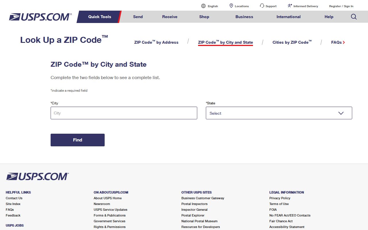
The capture separates the three forms so a city-wide list is not mistaken for verification of one address.
Keep the text printed in an old deed or directory, then save the standardized USPS form beside it. Changing the old citation itself can hide a direction, former unit label, or spelling that is vital to finding the same place in a historic volume.
Search Lawrence Residents by ZIP
A ZIP code directory narrows a large place into a manageable search area, but official tools expose different roles. County parcel data can associate an owner, situs address, mailing address, legal description, and polygon with a postal code. Kansas voter data is registration evidence with its own access rules. Neither source is a census of everyone present at an address.
- Verify the full address through USPS, including the apartment or suite field.
- Search Douglas County Property Information by address, name, or property identifier. Record the situs ZIP and mailing ZIP separately.
- Open the Tax Parcel GIS service or Lawrence Atlas to compare the parcel polygon with the city boundary and street segment.
- For an individual registration check, use Kansas VoterView with the required name and birth date. Do not treat it as a ZIP-wide resident list.
- Once the correct street is known, follow the address chain in the Lawrence street directory.
The property portal quick search accepts a name, address, or property identifier. Results can display owner name, situs address, account, property ID, neighborhood code, subdivision, legal description, property type, and value. County GIS adds address, city, state, ZIP, deed, book, page, PID, Quick Ref ID, and geometry. Preserve field names and the inspection date because the portal moved to its current system in June 2026.
A broader voter-data request uses a different channel. The Kansas Secretary of State's current CVR form allows paid extracts selected by geography, party, advance-voting list, and inactive-voter treatment. Protected identification fields are removed, and the requester must certify compliance with the statutory commercial-use limit. A CVR extract is an administrative voter file, not a statement that each registered person still occupies the listed Lawrence address. For a single registration check, VoterView is the narrower and more suitable route.
Note: A ZIP filter returns records carrying that field, not a verified list of all people who live within the postal area.
Lawrence Postal Facilities Explained
The Lawrence Main Post Office listing identifies the counter at 645 Vermont Street with a 66044-9998 facility ZIP. Jayhawk Station is listed at 1901 W. 31st Street with 66046-9998. These are service points, not proof that every address routed through them shares the counter's postal code.
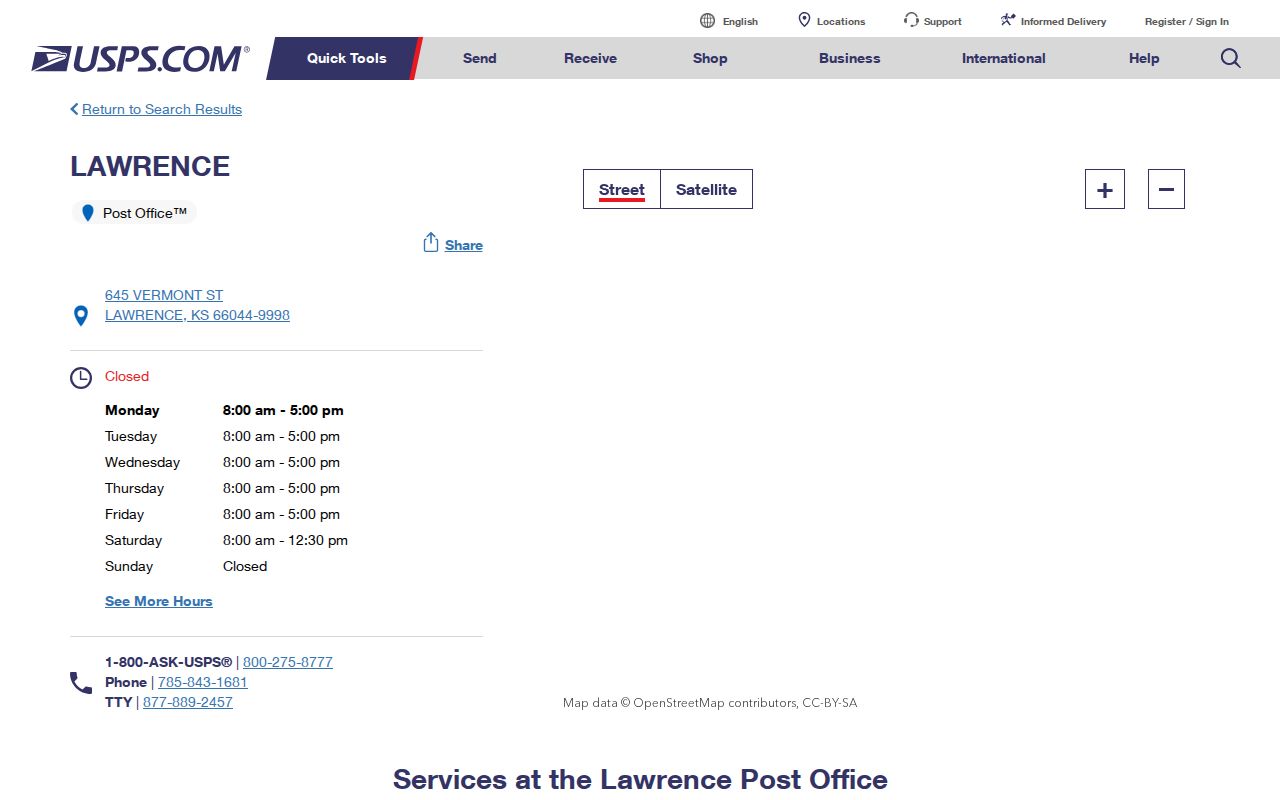
The listing gives an official postal-office checkpoint when a ZIP result needs direct confirmation.
USPS label materials group 66044, 66045, and 66049 under a Lawrence 66044 destination, while 66046 and 66047 group under Lawrence 66046. Read that as mail routing. It does not merge the five codes or move their local geography.
Lawrence ZIP Edge at 66050
A useful local trap appears northwest of Lawrence. The city's retail analysis shows 66050 in its broader trade geography, yet the USPS Lecompton location identifies Lecompton, Kansas 66050-9998. The Lawrence ZIP code directory therefore treats 66050 as adjacent Douglas County context, not as a sixth current Lawrence mailing ZIP.
Postal edge tip. When a planning map and USPS label differ, preserve both results and let the complete street address decide the mailing ZIP.
This matters for record requests. A market map may include nearby customers, while a city record system follows municipal jurisdiction and a county parcel system follows parcel geography. A postal label answers neither question by itself.
Lawrence ZIPs and City Limits
ZIP areas, Lawrence city limits, Douglas County lines, and planning districts serve separate purposes. Postal routes optimize delivery. City limits determine municipal authority. Parcel geometry follows recorded legal descriptions and county maintenance. The Lawrence retail map gives useful orientation, but USPS remains the postal authority for an address.
- ZIP Code
- A five-digit USPS delivery area. It is not a municipal boundary.
- ZIP+4
- The basic ZIP plus four digits that refine a delivery segment, such as one block or group of boxes.
- PO-box ZIP
- A code or ZIP+4 used for post-office boxes rather than street delivery.
- Unique ZIP
- A code assigned to a high-volume organization. No unique Lawrence ZIP was verified.
- Carrier route
- A delivery path within a ZIP. It can cross commonly used neighborhood lines.
For a boundary question, compare the Lawrence Atlas city-limit layer with the county parcel polygon. For postal delivery, return to USPS. For a formal address-assignment record not online, contact City Planning or County GIS, or make a specific Kansas Open Records Act request to the agency that holds it.
Lawrence Parcel ZIP Role Labels
Douglas County parcel cards can carry more than one address role. The situs address describes the property's physical location. Owner Info can show a mailing address used for tax correspondence. A legal description ties the parcel to a lot, block, subdivision, or survey description. Those values may not share one ZIP, and none alone proves who occupies the property.
| Parcel field | Meaning | ZIP caution |
|---|---|---|
| Situs address | Physical parcel location | Best parcel-side ZIP comparison |
| Mailing address | Tax correspondence destination | May be outside Lawrence |
| Legal description | Recorded land description | Usually has no postal role |
| GIS ZIP | Attribute on a maintained map layer | Check the layer date |
The distinction prevents a common false match. A trust, representative, or owner may receive mail elsewhere while the parcel remains in Lawrence. Compare roles instead of forcing them into one resident claim.
Historic Lawrence ZIP Crosswalk
Older Lawrence directories may predate the modern ZIP system, omit compass directions, or print an address differently from today's parcel card. The city's grid uses numbered east-west streets, and a missing E. or W. can point to the wrong property. East Lawrence's 1854 neighborhood fabric adds another reason to keep the original wording beside a current map.
Lawrence has unusually strong sources for testing that crosswalk. City directories begin in 1860, though coverage is intermittent through 1930, and later Polk editions are nearly complete from 1961. Telephone books begin in 1916 and become much more consistent from the 1940s through the 2000s. Sanborn maps cover 1883 through 1949, while county aerial photography begins in 1937. None of those early sources should be expected to print a modern five-digit ZIP. Their value is the dated street, lot, building, subscriber, or household evidence that can be matched to a present postal result.
Normalize a historic address in stages. Transcribe the volume, year, page, street form, and name exactly. Compare the street on a Sanborn map or old plat. Locate the legal description or present polygon. Then validate the modern mailing form through USPS. This Lawrence ZIP code workflow preserves the evidence while still producing a current search address.
The Lawrence Atlas can add historic-property, aerial, floodplain, and city-limit layers, while the county Tax Parcel service supplies the current polygon and parcel identifiers. Record the map layer and date used. A modern GIS label can help locate the old place, but it should never be copied backward into a directory citation as if it appeared in the original volume.
Note: A historical directory entry is dated evidence about the printed role, not proof of a present Lawrence resident or owner.